send link to app
Read, edit, convert and analyze GPS tracks and trails.
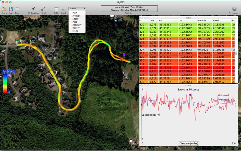
Shows GPS data on the map, with an XY graph and in tabulated form. Interact with any format and all will update. Edit coordinates in the table or move points on the map to correct GPS recordings.
All data can be color coded on the map so you can quickly see highs and lows.
Speed and Pace are calculated and displayed.
Imports GPX exchange format as well as MyMotion files.
Exports to GPX, KML and CSV.


